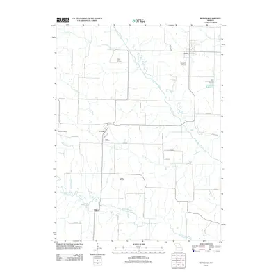
2012 Map of Rutledge
USGS Topo · Published 2012About this map
Rutledge and Gorin serve as the primary hubs in this section of Scotland County, connected by a network of rural roads that cross the drainage of the North Fabius River. The landscape is defined by the steady flow of the river and its tributaries, such as Long Branch and Indian Creek, where Indian Creek Cemetery stands near the water. To the south, Millport sits along the Middle Fabius River, marked by the notable Millport Bridge. The area exhibits a pattern of localized water management, evident in the Ella Ewing Reservoir and several watershed dams like the Bear Creek Watershed Dam C-23. Genealogists will find several distinct burial sites including Sand Hill Cemetery, Pauline Cemetery, and Ewing Cemetery, which provide geographical anchors for early family settlements in the region.
Find a feature on this map
58 named features on this map. Tap any name to fly to it.
Don’t see what you’re looking for? This feature index may not catch every label — zoom into the map to look around manually.
Map Details
Editions of this 2012 Rutledge Map
This is the sole edition of this map. No revisions or reprints were ever made.
Other maps of this area

1903 · Kahoka
USGS Topo · 1:125,000

1903 · Edina
USGS Topo · 1:125,000

1950 · Colony
USGS Topo · 1:24,000

1951 · Colony
USGS Topo · 1:24,000

1951 · Wyaconda
USGS Topo · 1:24,000
1951 · Deer Ridge
USGS Topo · 1:24,000

1954 · Centerville
USGS Topo · 1:250,000

1957 · Centerville
USGS Topo · 1:250,000

1958 · Centerville
USGS Topo · 1:250,000

1958 · Burlington
USGS Topo · 1:250,000