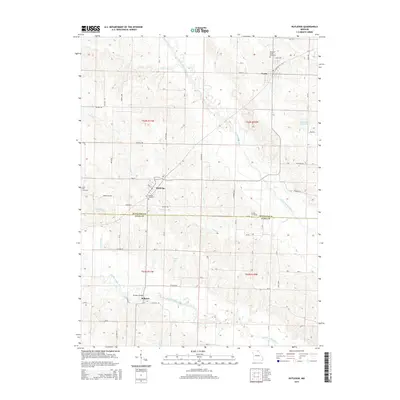
2015 Map of Rutledge
USGS Topo · Published 2015About this map
The North Fabius River and Middle Fabius River carve a dissected landscape across the border of Scotland and Knox Counties. Small settlements like Rutledge and Gorin anchor the northern half of the region, where the terrain transitions from flat-topped ridges to more complex drainage basins. In the south, the village of Millport sits near the Millport Bridge, marking a crossing of the Middle Fabius. Local genealogy is well-documented through scattered burial grounds, including Pauline Cemetery near Rutledge and Sand Hill Cemetery to the west. The presence of the Ella Ewing Reservoir and Shultz Lake indicates modern water management, while the dense network of county roads like Co Road 58 and Co Road 62 maintains the agricultural connectivity of this Missouri farming region.
Find a feature on this map
58 named features on this map. Tap any name to fly to it.
Don’t see what you’re looking for? This feature index may not catch every label — zoom into the map to look around manually.
Map Details
Editions of this 2015 Rutledge Map
This is the sole edition of this map. No revisions or reprints were ever made.
Other maps of this area

1903 · Kahoka
USGS Topo · 1:125,000

1903 · Edina
USGS Topo · 1:125,000

1950 · Colony
USGS Topo · 1:24,000

1951 · Colony
USGS Topo · 1:24,000

1951 · Wyaconda
USGS Topo · 1:24,000
1951 · Deer Ridge
USGS Topo · 1:24,000

1954 · Centerville
USGS Topo · 1:250,000

1957 · Centerville
USGS Topo · 1:250,000

1958 · Centerville
USGS Topo · 1:250,000

1958 · Burlington
USGS Topo · 1:250,000