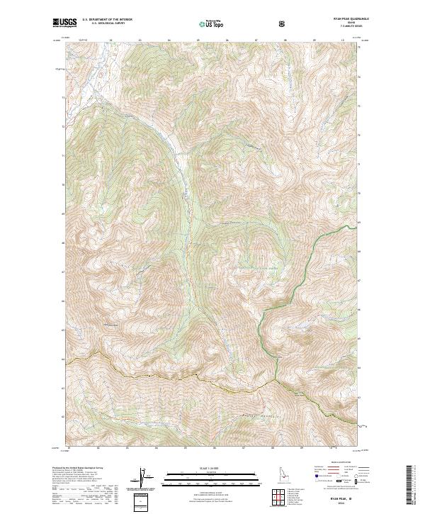
2024 Map of Ryan Peak
USGS Topo · Published 2024About this map
Ryan Peak and Glassford Peak dominate this high-altitude landscape in the Boulder Mountains, where the headwaters of several major Idaho river systems originate. The terrain serves as a significant hydrological divide, with the East Fork Salmon River flowing north while the North Fork Big Wood River and North Fork Big Lost River drain to the south and east. This 2024 survey documents the intersections of the Sawtooth National Forest and Challis National Forest, alongside the protected reaches of the Jim McClure-Jerry Peak Wilderness and Hemingway-Boulders Wilderness. The remote character of the area is underscored by primitive routes like Bowery Trl and Grand Prize Trl, which follow drainages such as Lost Mine Canyon and West Pass Creek into the high basins.
Find a feature on this map
43 named features on this map. Tap any name to fly to it.
Don’t see what you’re looking for? This feature index may not catch every label — zoom into the map to look around manually.
Map Details
Editions of this 2024 Ryan Peak Map
This is the sole edition of this map. No revisions or reprints were ever made.
Other maps of this area

1895 · Hailey
USGS Topo · 1:125,000

1897 · Hailey
USGS Topo · 1:125,000

1900 · Sawtooth
USGS Topo · 1:125,000

1919 · Custer
USGS Topo · 1:125,000

1922 · Custer
USGS Topo · 1:125,000

1929 · Bayhorse
USGS Topo · 1:125,000

1955 · Hailey
USGS Topo · 1:250,000

1957 · Challis
USGS Topo · 1:250,000

1959 · Hailey
USGS Topo · 1:250,000

1960 · Challis
USGS Topo · 1:250,000