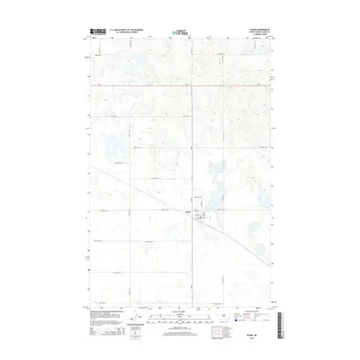
2014 Map of Ryder
USGS Topo · Published 2014About this map
Ryder serves as the central hub of this prairie landscape in Ward County, situated at the intersection of ND-23 and ND-28. The town’s layout is defined by a traditional grid, featuring streets like Andrews St and Corona St, alongside numbered thoroughfares such as 3rd Ave and 7th Ave. To the north, the Ryder Cem provides a point of genealogical interest for those researching local family histories in this part of North Dakota. The surrounding terrain is heavily marked by the glaciated topography of the Missouri Coteau, characterized by numerous small, scattered wetlands and depressions that break up the section-line road network. This rural expanse is crisscrossed by an extensive system of gravel roads, including 233rd Ave SW and 345th Ave SW, which facilitate movement across the agricultural land and connect the isolated farmsteads typical of the region.
Find a feature on this map
23 named features on this map. Tap any name to fly to it.
Don’t see what you’re looking for? This feature index may not catch every label — zoom into the map to look around manually.
Map Details
Editions of this 2014 Ryder Map
This is the sole edition of this map. No revisions or reprints were ever made.
Other maps of this area

1954 · Minot
USGS Topo · 1:250,000

1954 · McClusky
USGS Topo · 1:250,000

1956 · Blue Hill
USGS Topo · 1:24,000

1956 · Douglas West
USGS Topo · 1:24,000

1956 · Roseglen
USGS Topo · 1:24,000

1958 · McClusky
USGS Topo · 1:250,000

1958 · Minot
USGS Topo · 1:250,000

1980 · Minot
USGS Topo · 1:100,000

1980 · Lake Vernon
USGS Topo · 1:24,000

1980 · Plaza SE
USGS Topo · 1:24,000