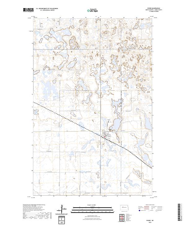
2024 Map of Ryder
USGS Topo · Published 2024About this map
Ryder serves as the central hub of this prairie landscape, where the grid of the Public Land Survey System defines the movement of local life. The town is situated at the junction of several key local routes, including Main St, 4th Ave, and 3rd Ave, reflecting the organized growth typical of North Dakota grain-trading settlements. To the north, Rosehill Cem provides a genealogical touchpoint for families of Ward County, situated just outside the residential limits on Andrew St.
Find a feature on this map
28 named features on this map. Tap any name to fly to it.
Don’t see what you’re looking for? This feature index may not catch every label — zoom into the map to look around manually.
Map Details
Editions of this 2024 Ryder Map
This is the sole edition of this map. No revisions or reprints were ever made.
Other maps of this area

1954 · Minot
USGS Topo · 1:250,000

1954 · McClusky
USGS Topo · 1:250,000

1956 · Blue Hill
USGS Topo · 1:24,000

1956 · Douglas West
USGS Topo · 1:24,000

1956 · Roseglen
USGS Topo · 1:24,000

1958 · McClusky
USGS Topo · 1:250,000

1958 · Minot
USGS Topo · 1:250,000

1980 · Minot
USGS Topo · 1:100,000

1980 · Lake Vernon
USGS Topo · 1:24,000

1980 · Plaza SE
USGS Topo · 1:24,000