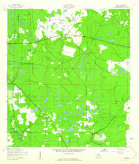
1944 Map of Rye
USGS Topo · Published 1961About this map
Rye and Manhattan are central points in this landscape of the mid-1940s, situated within a complex network of waterways in northern Manatee County. The terrain is defined by the winding course of Gamble Creek and the S Fk Little Manatee R in the north, while Goddard Branch and Rye Creek converge near the settlement of Rye. To the east, Oak Knoll sits near the headwaters of Gilley Creek. A notable vestige of earlier industrial activity is the Old Railroad Grade that cuts across the northern half of the quadrangle, reflecting a time when rail transport was critical to the local economy. The area is dotted with numerous small water bodies, including the Gilly Lakes, interspersed among pockets of vegetation and cleared land, illustrating the transition between the region’s natural drainage and early twentieth-century rural development.
Find a feature on this map
13 named features on this map. Tap any name to fly to it.
Don’t see what you’re looking for? This feature index may not catch every label — zoom into the map to look around manually.
Map Details
Editions of this 1944 Rye Map
2 editions found
Other maps of this area

1944 · Ruskin
USGS Topo · 1:31,680

1944 · Rye
USGS Topo · 1:31,680

1944 · Wimauma
USGS Topo · 1:31,680

1944 · Verna
USGS Topo · 1:31,680

1944 · Lorraine
USGS Topo · 1:31,680

1944 · Parish
USGS Topo · 1:31,680

1947 · Ruskin
USGS Topo · 1:25,000

1947 · Wimauma
USGS Topo · 1:25,000

1956 · Myakka City NW
USGS Topo · 1:24,000

1956 · Ft Lonesome
USGS Topo · 1:24,000