
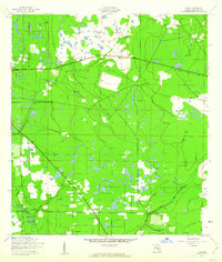
1944 Map of Rye
USGS Topo · Published 1944About this map
Manhattan and the small settlement at Oak Knoll anchor this 1944 topographic survey of inland Manatee County. The landscape is defined by the slow-moving drainage of the Manatee River and its various tributaries, including Gamble Creek, Gilley Creek, and Boggy Creek. A series of isolated wetlands and water bodies such as Gilly Lakes dot the central precincts, indicating the low-lying, intermittently flooded nature of the terrain during the mid-1940s.
Find a feature on this map
20 named features on this map. Tap any name to fly to it.
Don’t see what you’re looking for? This feature index may not catch every label — zoom into the map to look around manually.
Map Details
Editions of this 1944 Rye Map
2 editions found
Other maps of this area

1944 · Ruskin
USGS Topo · 1:31,680

1944 · Wimauma
USGS Topo · 1:31,680

1944 · Verna
USGS Topo · 1:31,680

1944 · Lorraine
USGS Topo · 1:31,680

1944 · Parish
USGS Topo · 1:31,680

1947 · Ruskin
USGS Topo · 1:25,000

1947 · Wimauma
USGS Topo · 1:25,000

1956 · Myakka City NW
USGS Topo · 1:24,000

1956 · Ft Lonesome
USGS Topo · 1:24,000
1956 · Wimauma
USGS Topo · 1:24,000