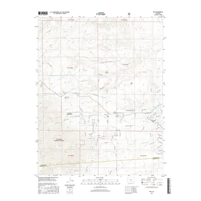
2016 Map of Rye
USGS Topo · Published 2016About this map
Rye and Colorado City sit at the eastern edge of the San Isabel National Forest, where the high plains meet the rising foothills of the Wet Mountains. This landscape is defined by a sophisticated network of water management, illustrated by the Middle Muddy Cr Standard Ditch and numerous seasonal watercourses like Greenhorn Cr and Little Graneros Cr. The map details the transition from established ranching lands, such as the Jackson Ranch Muddy Creek Farm Fire Acc, to modern residential layouts in Colorado City. Genealogists will find interest in the proximity of Mount Olivet Cem and Brookside Cem near the town center of Rye, while recreational history is preserved in routes like the Greenhorn Trail and the naming of Cuerna Verde Park. Prominent landmarks like Table Mtn and Huckleberry Hills provide a sense of the rugged local relief.
Find a feature on this map
106 named features on this map. Tap any name to fly to it.
Don’t see what you’re looking for? This feature index may not catch every label — zoom into the map to look around manually.
Map Details
Editions of this 2016 Rye Map
This is the sole edition of this map. No revisions or reprints were ever made.
Other maps of this area

1889 · Canon City
USGS Topo · 1:125,000

1889 · Huerfano Park
USGS Topo · 1:125,000

1891 · Walsenburg
USGS Topo · 1:125,000

1891 · Pueblo
USGS Topo · 1:125,000

1892 · Huerfano Park
USGS Topo · 1:125,000

1892 · Canon City
USGS Topo · 1:125,000

1894 · Walsenburg
USGS Topo · 1:125,000

1894 · Pueblo
USGS Topo · 1:125,000

1896 · Pueblo
USGS Topo · 1:125,000

1897 · Pueblo
USGS Topo · 1:125,000