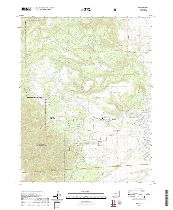
2022 Map of Rye
USGS Topo · Published 2022About this map
The settlement of Rye sits at the foot of the Wet Mountains, where the high plains meet the eastern edge of the San Isabel National Forest. This modern survey details a landscape defined by sharp elevation changes and vital water management, featuring the Standard Ditch and numerous seasonal drainages like Greenhorn Cr and Graneros Cr. The map reveals the community's local history through the presence of Mount Olivet Cem and Brookside Cem located near the town center. Local landmarks such as Table Mtn, the Huckleberry Hills, and the transition into Cuerna Verde Park highlight the varied terrain. Significant road networks, including Old San Isabel Rd and Bartlett Trail Rd, snake through canyons like Gleason Canyon, documenting the modern infrastructure of this part of Pueblo County.
Find a feature on this map
113 named features on this map. Tap any name to fly to it.
Don’t see what you’re looking for? This feature index may not catch every label — zoom into the map to look around manually.
Map Details
Editions of this 2022 Rye Map
This is the sole edition of this map. No revisions or reprints were ever made.
Other maps of this area

1889 · Canon City
USGS Topo · 1:125,000

1889 · Huerfano Park
USGS Topo · 1:125,000

1891 · Walsenburg
USGS Topo · 1:125,000

1891 · Pueblo
USGS Topo · 1:125,000

1892 · Huerfano Park
USGS Topo · 1:125,000

1892 · Canon City
USGS Topo · 1:125,000

1894 · Walsenburg
USGS Topo · 1:125,000

1894 · Pueblo
USGS Topo · 1:125,000

1896 · Pueblo
USGS Topo · 1:125,000

1897 · Pueblo
USGS Topo · 1:125,000