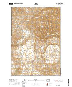
2020 Map of Rye Valley
USGS Topo · Published 2020About this map
Rye Valley serves as the focal point of this high-desert landscape in eastern Oregon, situated near the boundary where Baker County meets Malheur County. The map details a complex network of springs and gulches essential for life in this arid terrain, including Suitter Spring, Quaker Spring, and the prominent Opal Mine Draw. The local history of the valley is anchored by the Rye Valley Cem and the East Fork Rattlesnake Gulch, while high peaks like Pedro Mtn and Weatherby Mtn dominate the skyline. The presence of numerous named draws and gulches such as Whisky Gulch and Dumas Gulch points to a landscape shaped by both natural erosion and historical human activity, likely linked to the region's mining and ranching past. Roads like Shirttail Creek Rd and Durbin Creek Rd trace the paths through the high flats and along the Dixie Cr drainage system.
Find a feature on this map
74 named features on this map. Tap any name to fly to it.
Don’t see what you’re looking for? This feature index may not catch every label — zoom into the map to look around manually.
Map Details
Editions of this 2020 Rye Valley Map
This is the sole edition of this map. No revisions or reprints were ever made.
Other maps of this area

1901 · Baker City
USGS Topo · 1:125,000

1915 · Pine
USGS Topo · 1:125,000

1951 · Huntington
USGS Topo · 1:62,500

1955 · Baker
USGS Topo · 1:250,000

1957 · Durkee
USGS Topo · 1:62,500

1959 · Baker
USGS Topo · 1:250,000

1964 · Bridgeport
USGS Topo · 1:62,500

1967 · Lost Basin
USGS Topo · 1:24,000

1980 · Brogan
USGS Topo · 1:100,000

1981 · Baker
USGS Topo · 1:100,000