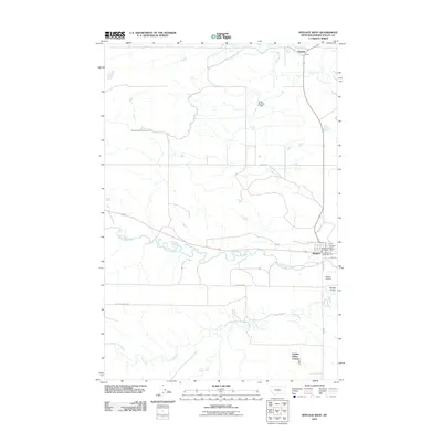
2011 Map of Ryegate West
USGS Topo · Published 2011About this map
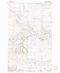
The Musselshell River carves a winding path through this Golden Valley County landscape, anchoring the town of Ryegate. In this 2011 edition, the community center is clearly defined by local infrastructure including the Ryegate Post Office, the Ryegate Vol Fire Dept, and the Ryegate Airport to the south. The surrounding terrain is a network of water management and agricultural settlements, highlighted by the Deadmans Basin Outlet Canal and the Golden Valley Colony located near the southern reaches of Fish Creek.
Find a feature on this map
20 named features on this map. Tap any name to fly to it.
Don’t see what you’re looking for? This feature index may not catch every label — zoom into the map to look around manually.
Map Details
Editions of this 2011 Ryegate West Map
This is the sole edition of this map. No revisions or reprints were ever made.
Other maps of this area

1889 · Big Snowy Mountain
USGS Topo · 1:250,000

1893 · Big Snowy Mountain
USGS Topo · 1:250,000

1954 · Roundup
USGS Topo · 1:250,000

1958 · Roundup
USGS Topo · 1:250,000
1985 · Locomotive Butte
USGS Topo · 1:24,000
1985 · Mount Sinai
USGS Topo · 1:24,000
1985 · O'Brien Hill
USGS Topo · 1:24,000

1986 · Ryegate West
USGS Topo · 1:24,000
1986 · Ryegate East
USGS Topo · 1:24,000

1986 · Halbert Creek South
USGS Topo · 1:24,000
Featured Places
- Ryegate, MT
- Franklin, MT
- Golden Valley Colony, MT
- Golden Valley Hutterite Colony, MT
- Golden Valley County, MT