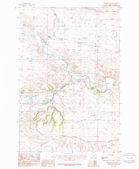
1986 Map of Ryegate East
USGS Topo · Published 1986About this map
Ryegate sits at the western edge of this mid-1980s topographic study, positioned near the confluence of several key waterways in the Montana landscape. The Musselshell River meanders across the center of the sheet, joined by the winding courses of Careless Creek from the north and Fish Creek from the south. This confluence area highlights the importance of water management and transportation in the region's development, evidenced by the presence of Sewage Disposal Ponds and a Landing Strip near the town center.
Find a feature on this map
9 named features on this map. Tap any name to fly to it.
Don’t see what you’re looking for? This feature index may not catch every label — zoom into the map to look around manually.
Map Details
Editions of this 1986 Ryegate East Map
This is the sole edition of this map. No revisions or reprints were ever made.
Other maps of this area

1889 · Big Snowy Mountain
USGS Topo · 1:250,000

1893 · Big Snowy Mountain
USGS Topo · 1:250,000

1954 · Roundup
USGS Topo · 1:250,000

1958 · Roundup
USGS Topo · 1:250,000
1985 · Locomotive Butte
USGS Topo · 1:24,000
1985 · Mount Sinai
USGS Topo · 1:24,000
1985 · Eagle Point
USGS Topo · 1:24,000

1986 · Ryegate West
USGS Topo · 1:24,000

1986 · Wallum
USGS Topo · 1:24,000

1986 · Cushman NW
USGS Topo · 1:24,000