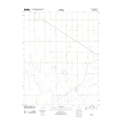
2012 Map of Ryus
USGS Topo · Published 2012About this map
Ryus stands as the primary focal point in this section of southwestern Kansas, where the organized grid of county roads meets the diagonal cut of the local highway. This landscape is defined by the transition from the high, flat agricultural plains of Grant County to the textured breaks of the Cimarron River valley. The river winds through the southern portion of the map, carving a distinct natural path across a territory otherwise dominated by the rectilinear geometry of section lines like Co Rd-180 and Road X. Local transit is centered on the crossing of Co Road AA and Road 15 E, illustrating the late-modern infrastructure serving the rural farming community. The terrain around the river reveals complex drainage patterns that contrast sharply with the industrial precision of the surrounding road network.
Find a feature on this map
21 named features on this map. Tap any name to fly to it.
Don’t see what you’re looking for? This feature index may not catch every label — zoom into the map to look around manually.
Map Details
Editions of this 2012 Ryus Map
This is the sole edition of this map. No revisions or reprints were ever made.
Other maps of this area

1891 · Larned
USGS Topo · 1:125,000

1896 · Garden
USGS Topo · 1:125,000

1900 · Lakin
USGS Topo · 1:125,000

1944 · Moscow
USGS Topo · 1:62,500

1945 · Moscow
USGS Topo · 1:62,500

1955 · Dodge City
USGS Topo · 1:250,000

1958 · Dodge City
USGS Topo · 1:250,000

1959 · Dodge City
USGS Topo · 1:250,000

1959 · Hickok
USGS Topo · 1:24,000

1960 · Hickok SE
USGS Topo · 1:24,000