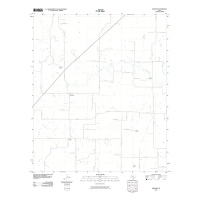
2010 Map of Sabanno
USGS Topo · Published 2010About this map
Sabanno serves as the focal point of this rural Eastland County landscape, where the Sabana River and its tributaries define the local geography. The area's settlement history is deeply recorded through a series of local burial grounds, including Sabanno Cemetery just north of the community and Liberty Cemetery to the south. Further east, Salt Tank Cemetery and Wayside Cemetery offer additional primary points of interest for genealogists tracking early Texas families in this region.
Find a feature on this map
43 named features on this map. Tap any name to fly to it.
Don’t see what you’re looking for? This feature index may not catch every label — zoom into the map to look around manually.
Map Details
Editions of this 2010 Sabanno Map
This is the sole edition of this map. No revisions or reprints were ever made.
Other maps of this area

1894 · Eastland
USGS Topo · 1:125,000

1931 · Baird
USGS Topo · 1:125,000

1932 · Baird
USGS Topo · 1:125,000

1954 · Abilene
USGS Topo · 1:250,000

1958 · Abilene
USGS Topo · 1:250,000
1960 · Cross Cut
USGS Topo · 1:24,000
1966 · Rising Star
USGS Topo · 1:24,000

1966 · Scranton
USGS Topo · 1:24,000

1966 · Putnam South
USGS Topo · 1:24,000

1966 · Cisco South
USGS Topo · 1:24,000