
1966 Map of Scranton
USGS Topo · Published 1969About this map
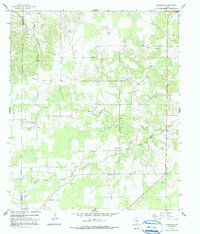
The South Fork Leon River meanders across this West Texas landscape, shaping the development of Eastland County during the mid-1960s. The map captures small rural communities such as Scranton and Nimrod, alongside the cluster of homes at Mitchell. This area is particularly rich for genealogical research, documenting several family and community burial grounds including Mitchell Cem, Pisgah Cem, Monroe Cem, and Haskell Cem. The terrain is marked by numerous Gravel Pit operations and a network of buried utilities indicated by Pipeline clearings. Water management is a visible priority for local landholders, evidenced by the many small ponds and Oil Wells scattered through the drainage of Dinner Creek. The transition from the ranching heartland to industrial extraction is clear in the distribution of these well sites and gravel excavations among the wooded draws.
Find a feature on this map
17 named features on this map. Tap any name to fly to it.
Don’t see what you’re looking for? This feature index may not catch every label — zoom into the map to look around manually.
Map Details
Editions of this 1966 Scranton Map
2 editions found
Other maps of this area

1894 · Eastland
USGS Topo · 1:125,000

1931 · Baird
USGS Topo · 1:125,000

1932 · Baird
USGS Topo · 1:125,000

1954 · Abilene
USGS Topo · 1:250,000

1958 · Abilene
USGS Topo · 1:250,000

1966 · Cisco North
USGS Topo · 1:24,000

1966 · Putnam South
USGS Topo · 1:24,000
1966 · Bernie Lake
USGS Topo · 1:24,000

1966 · Cisco South
USGS Topo · 1:24,000
1966 · Putnam North
USGS Topo · 1:24,000