
1966 Map of Cisco South
USGS Topo · Published 1969About this map
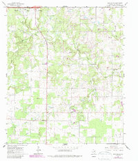
The Corporate Boundary of Cisco marks the northern edge of this mid-1960s landscape, where the town gives way to the drainage systems of the South Fork Leon River. The map reveals a transition from municipal development to a rural economy defined by resource extraction and small-scale agriculture. Evidence of the region’s earlier transportation infrastructure is visible in the Old Railroad Grade cutting through the terrain, while numerous Gravel Pits, Quarries, and Oil Wells indicate a landscape heavily utilized for its mineral wealth.
Find a feature on this map
16 named features on this map. Tap any name to fly to it.
Don’t see what you’re looking for? This feature index may not catch every label — zoom into the map to look around manually.
Map Details
Editions of this 1966 Cisco South Map
2 editions found
Other maps of this area

1894 · Eastland
USGS Topo · 1:125,000

1931 · Baird
USGS Topo · 1:125,000

1932 · Baird
USGS Topo · 1:125,000

1954 · Abilene
USGS Topo · 1:250,000

1958 · Abilene
USGS Topo · 1:250,000

1966 · Cisco North
USGS Topo · 1:24,000

1966 · Carbon
USGS Topo · 1:24,000

1966 · Scranton
USGS Topo · 1:24,000

1966 · Eastland
USGS Topo · 1:24,000
1966 · Bernie Lake
USGS Topo · 1:24,000