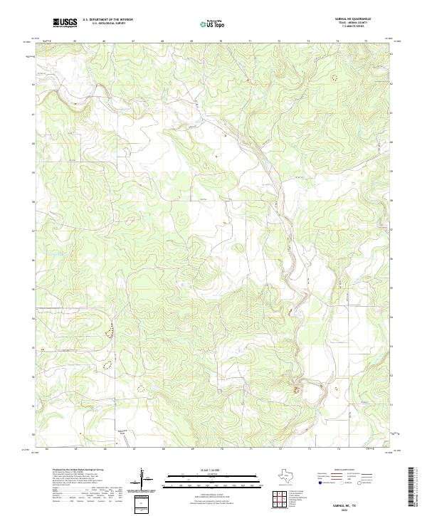
2022 Map of Sabinal NE
USGS Topo · Published 2022About this map
Glasscock Field and a network of seasonal watercourses define this rural stretch of Medina County, where the topography transitions through a series of limestone ridges and creek valleys. The drainage pattern is dominated by Seco Cr, also labeled as Seco Creek in its southern reaches, which is joined by tributaries including Rocky Cr and Cedar Cr. The landscape is etched with the courses of Little Comanche Cr and Rancheros Cr, illustrating the complex hydrology of the Texas Hill Country fringe.
Find a feature on this map
21 named features on this map. Tap any name to fly to it.
Don’t see what you’re looking for? This feature index may not catch every label — zoom into the map to look around manually.
Map Details
Editions of this 2022 Sabinal NE Map
This is the sole edition of this map. No revisions or reprints were ever made.
Other maps of this area

1954 · San Antonio
USGS Topo · 1:250,000

1956 · Sabinal
USGS Topo · 1:62,500

1956 · New Fountain
USGS Topo · 1:62,500

1956 · Tarpley
USGS Topo · 1:62,500

1956 · Bandera
USGS Topo · 1:62,500

1957 · San Antonio
USGS Topo · 1:250,000
1969 · Twin Hollow
USGS Topo · 1:24,000
1969 · Texas Mountain
USGS Topo · 1:24,000

1969 · Sabinal NE
USGS Topo · 1:24,000

1969 · Comanche Waterhole
USGS Topo · 1:24,000