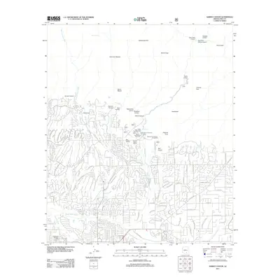
2011 Map of Sabino Canyon
USGS Topo · Published 2011About this map
Sabino Creek flows through the center of this landscape, marking a sharp transition between the dense residential expansion of northeast Tucson and the protected wilderness of the Santa Catalina Mountains. The map illustrates the 2011 suburban footprint as it meets the foothills, where streets like N Sabino Canyon Rd and E Snyder Rd terminate at the mouths of steep drainages. Within this mountain-desert interface, the Fenster School and a small local Airport sit near the base of the peaks, while the Sabino Dam Overlook Picnic Area serves as a gateway to the canyons above. Further north, the terrain becomes increasingly complex, characterized by landmarks such as Thimble Peak, McFall Crags, and Geronimo Meadow. This survey provides a precise record of water sources in the arid environment, from the Sabino Lake reservoir to high-elevation points like Mormon Spring and Gibbon Springs.
Find a feature on this map
105 named features on this map. Tap any name to fly to it.
Don’t see what you’re looking for? This feature index may not catch every label — zoom into the map to look around manually.
Map Details
Editions of this 2011 Sabino Canyon Map
This is the sole edition of this map. No revisions or reprints were ever made.
Other maps of this area

1904 · Tucson
USGS Topo · 1:125,000

1905 · Tucson
USGS Topo · 1:125,000

1948 · Tucson
USGS Topo · 1:62,500

1956 · Tucson
USGS Topo · 1:250,000

1957 · Tucson East
USGS Topo · 1:24,000

1957 · Bellota Ranch
USGS Topo · 1:62,500

1957 · Tucson
USGS Topo · 1:24,000

1957 · Tucson
USGS Topo · 1:62,500

1957 · Rincon Valley
USGS Topo · 1:62,500

1957 · Sabino Canyon
USGS Topo · 1:24,000