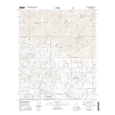
2014 Map of Sabino Canyon
USGS Topo · Published 2014About this map
Tucson reaches toward the steep canyons of the Coronado National Forest in this 2014 survey. The map details a landscape where urban expansion meets the desert foothills, anchored by the community of Tanque Verde and the historic presence of E Lawn Palms Cem in the southwest corner. The transition from grid-iron streets like N Craycroft Rd to the winding suburban developments shows the modern residential character of the Santa Catalina foothills.
Find a feature on this map
58 named features on this map. Tap any name to fly to it.
Don’t see what you’re looking for? This feature index may not catch every label — zoom into the map to look around manually.
Map Details
Editions of this 2014 Sabino Canyon Map
This is the sole edition of this map. No revisions or reprints were ever made.
Other maps of this area

1904 · Tucson
USGS Topo · 1:125,000

1905 · Tucson
USGS Topo · 1:125,000

1948 · Tucson
USGS Topo · 1:62,500

1956 · Tucson
USGS Topo · 1:250,000

1957 · Tucson East
USGS Topo · 1:24,000

1957 · Bellota Ranch
USGS Topo · 1:62,500

1957 · Tucson
USGS Topo · 1:24,000

1957 · Tucson
USGS Topo · 1:62,500

1957 · Rincon Valley
USGS Topo · 1:62,500

1957 · Sabino Canyon
USGS Topo · 1:24,000