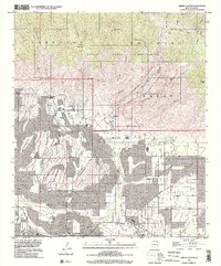
1996 Map of Sabino Canyon
USGS Topo · Published 2002About this map
Tucson expands into the foothills of the Santa Catalina Mountains in this mid-1990s representation of the desert landscape. The map illustrates the suburban interface where residential blocks meet the Coronado National Forest and the Pusch Ridge Wilderness. Within this transition, institutional landmarks like the Southern Arizona School For Boys and the Stone House are noted alongside recreational developments including the Ventana Canyon Golf Course and Fort Lowell Park.
Find a feature on this map
60 named features on this map. Tap any name to fly to it.
Don’t see what you’re looking for? This feature index may not catch every label — zoom into the map to look around manually.
Map Details
Editions of this 1996 Sabino Canyon Map
This is the sole edition of this map. No revisions or reprints were ever made.
Other maps of this area

1904 · Tucson
USGS Topo · 1:125,000

1905 · Tucson
USGS Topo · 1:125,000

1948 · Tucson
USGS Topo · 1:62,500

1956 · Tucson
USGS Topo · 1:250,000

1957 · Tucson East
USGS Topo · 1:24,000

1957 · Bellota Ranch
USGS Topo · 1:62,500

1957 · Tucson
USGS Topo · 1:24,000

1957 · Tucson
USGS Topo · 1:62,500

1957 · Rincon Valley
USGS Topo · 1:62,500

1957 · Sabino Canyon
USGS Topo · 1:24,000