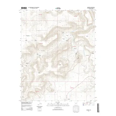
2013 Map of Sabinoso
USGS Topo · Published 2013About this map
The confluence of the Mora River and the Canadian River anchors this canyon-dominated landscape in San Miguel County. The terrain is defined by a series of dramatic geographic features including Cañon Largo, Cañon Gonzales, and the heights of Las Mesas Negras. Small settlements and family names are scattered throughout the draws and mesas, with Ancon and Sabinoso serving as central points. The mapping of Cañon Largo Cem provides a specific point of interest for genealogists tracing local families in this part of northeastern New Mexico.
Find a feature on this map
33 named features on this map. Tap any name to fly to it.
Don’t see what you’re looking for? This feature index may not catch every label — zoom into the map to look around manually.
Map Details
Editions of this 2013 Sabinoso Map
This is the sole edition of this map. No revisions or reprints were ever made.
Other maps of this area

1892 · Watrous
USGS Topo · 1:125,000

1894 · Watrous
USGS Topo · 1:125,000

1954 · Santa Fe
USGS Topo · 1:250,000

1958 · Santa Fe
USGS Topo · 1:250,000

1964 · Canon Ancho
USGS Topo · 1:24,000

1971 · Alamito
USGS Topo · 1:24,000

1971 · Canon Olguin
USGS Topo · 1:24,000

1971 · Canon Encierro
USGS Topo · 1:24,000

1972 · Arroyo Alamocito
USGS Topo · 1:24,000
1972 · Maes
USGS Topo · 1:24,000