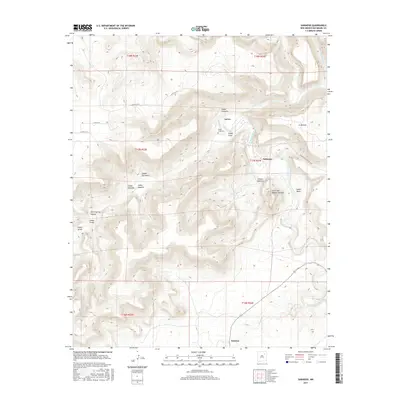
2017 Map of Sabinoso
USGS Topo · Published 2017About this map
Ancon and Sanchez occupy a landscape deeply etched by the winding course of the Canadian River and its numerous tributary canyons. This 2017 topographic study highlights the complex drainage patterns of San Miguel County, where the terrain is dominated by high mesas and steep-walled features such as Cañon Largo and Cañon Sabinoso. The placement of the Cañon Largo Cem near the river underscores the historical relationship between these intermittent water sources and local settlement patterns.
Find a feature on this map
27 named features on this map. Tap any name to fly to it.
Don’t see what you’re looking for? This feature index may not catch every label — zoom into the map to look around manually.
Map Details
Editions of this 2017 Sabinoso Map
This is the sole edition of this map. No revisions or reprints were ever made.
Other maps of this area

1892 · Watrous
USGS Topo · 1:125,000

1894 · Watrous
USGS Topo · 1:125,000

1954 · Santa Fe
USGS Topo · 1:250,000

1958 · Santa Fe
USGS Topo · 1:250,000

1964 · Canon Ancho
USGS Topo · 1:24,000

1971 · Alamito
USGS Topo · 1:24,000

1971 · Canon Olguin
USGS Topo · 1:24,000

1971 · Canon Encierro
USGS Topo · 1:24,000

1972 · Arroyo Alamocito
USGS Topo · 1:24,000
1972 · Maes
USGS Topo · 1:24,000