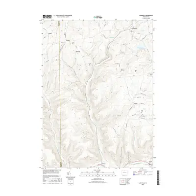
2016 Map of Sabinsville
USGS Topo · Published 2016About this map
Sabinsville and its surrounding hamlets occupy the high plateau and deeply carved valleys of Tioga County, where the headwaters of Potter Brook and Long Run begin their descent toward larger drainage basins. The landscape is characterized by its agricultural pockets and dispersed family cemeteries, such as the West Beech Woods - Clark Cem and Larrison Cem, which speak to the long-standing settlement of the upland ridges. Local transportation follows the natural contours of the land, with sr4001 and sr1005 connecting the smaller clusters of Mixtown and Gurnee. To the south, the terrain drops significantly into the valley of Pine Creek at Gaines, where the community sits along the corridor of Rte 6. Notable landmarks include Sharretts Airport perched on the eastern heights near Beech Hill and several prominent valleys including Bend Gully and Shin Hollow.
Find a feature on this map
93 named features on this map. Tap any name to fly to it.
Don’t see what you’re looking for? This feature index may not catch every label — zoom into the map to look around manually.
Map Details
Editions of this 2016 Sabinsville Map
This is the sole edition of this map. No revisions or reprints were ever made.
Other maps of this area

1899 · Gaines
USGS Topo · 1:62,500

1900 · Gaines
USGS Topo · 1:62,500

1900 · Elkland
USGS Topo · 1:62,500

1946 · Tiadaghton
USGS Topo · 1:24,000

1946 · Antrim
USGS Topo · 1:62,500

1947 · Galeton
USGS Topo · 1:62,500

1947 · Galeton
USGS Topo · 1:24,000

1947 · Marshlands
USGS Topo · 1:24,000
1948 · Tiadaghton
USGS Topo · 1:24,000
1949 · Galeton
USGS Topo · 1:24,000
Featured Places
- Clymer Township, PA
- Gaines Township, PA
- Hector Township, PA
- Davis Station, Clymer Township
- Gurnee, Gaines Township