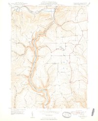
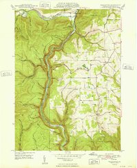
1948 Map of Tiadaghton
USGS Topo · Published 1948About this map
Pine Creek Gorge dominates this landscape, where the New York Central and Baltimore and Ohio railroads parallel the winding Pine Creek. In the late 1940s, the area around Ansonia and the southern settlement of Tiadaghton served as a gateway to this dramatic canyon system. The map reveals a transition from the narrow, river-focused transit corridor to the upland farming communities of Delmar and Moris townships. Notable social centers like the Middle Ridge Ch and Sherman Sch stand on the higher plateaus, while small clusters like Olmsville and Thumptown appear on the eastern edge. The topography is meticulously detailed, showing viewpoints such as Colton Point and Harrison Lookout that overlook the steep descents into the gorge, illustrating the area's importance for both industry and early conservation.
Find a feature on this map
50 named features on this map. Tap any name to fly to it.
Don’t see what you’re looking for? This feature index may not catch every label — zoom into the map to look around manually.
Map Details
Editions of this 1948 Tiadaghton Map
2 editions found
Other maps of this area

1899 · Gaines
USGS Topo · 1:62,500

1900 · Gaines
USGS Topo · 1:62,500

1900 · Elkland
USGS Topo · 1:62,500

1946 · Tiadaghton
USGS Topo · 1:24,000

1946 · Antrim
USGS Topo · 1:62,500

1946 · Cedar Run
USGS Topo · 1:24,000

1946 · Antrim
USGS Topo · 1:24,000

1946 · Morris
USGS Topo · 1:24,000

1947 · Galeton
USGS Topo · 1:62,500

1947 · Lee Fire Tower
USGS Topo · 1:24,000
Featured Places
- Morris Township, PA
- Gaines Township, PA
- Tiadaghton, Delmar Township
- Delmar Township, PA
- Elk Township, PA