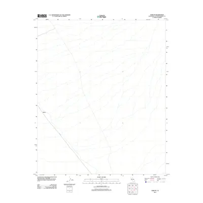
2012 Map of Sablon
USGS Topo · Published 2012About this map
Sablon stands as a distinct point of reference in the high desert of San Bernardino County, where the stark topography is defined by the ephemeral drainage patterns of the Mojave landscape. This 2012 survey documents the isolation of this corner of the California interior, showing the passage of Cadiz Rd as it cuts diagonally through the southern portion of the quadrangle. The map is characterized by its extensive network of dry washes and desert terrain, providing a clear record of the area's physical geography in the early 21st century. For those researching the history of desert travel or regional land management, these detailed contours and road alignments offer an essential look at the infrastructure that connects this remote settlement to the broader region.
Find a feature on this map
2 named features on this map. Tap any name to fly to it.
Don’t see what you’re looking for? This feature index may not catch every label — zoom into the map to look around manually.
Map Details
Editions of this 2012 Sablon Map
This is the sole edition of this map. No revisions or reprints were ever made.
Other maps of this area

1942 · Amboy
USGS Topo · 1:250,000

1943 · Amboy
USGS Topo · 1:250,000

1943 · Turtle Mts.
USGS Topo · 1:62,500

1943 · Iron Mountains
USGS Topo · 1:62,500

1954 · Needles
USGS Topo · 1:250,000

1954 · Turtle Mountains
USGS Topo · 1:62,500

1954 · Rice
USGS Topo · 1:62,500

1956 · Needles
USGS Topo · 1:250,000

1956 · Milligan
USGS Topo · 1:62,500

1956 · Iron Mountains
USGS Topo · 1:62,500