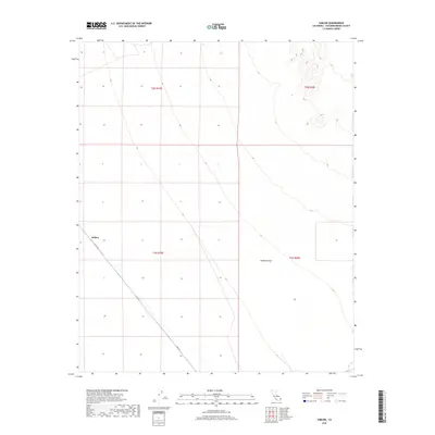
2018 Map of Sablon
USGS Topo · Published 2018About this map
Sablon sits as a solitary point of reference in this southeastern stretch of the Mojave Desert, marking a landscape defined by expansive desert plains and gradual elevation changes. The settlement, positioned along the diagonal corridor of Cadiz Rd, serves as a primary marker in an area characterized by the transition between several townships including t2n r19e, t2n r20e, t1n r19e, and t1n r20e. The terrain to the northeast rises toward complex contour formations, indicating the presence of highland features that overlook the desert floor. This 2018 survey documents the minimalist infrastructure of this arid region, where the singular road serves as the lifeline connecting the scattered geographic points within the vast California desert interior.
Find a feature on this map
7 named features on this map. Tap any name to fly to it.
Don’t see what you’re looking for? This feature index may not catch every label — zoom into the map to look around manually.
Map Details
Editions of this 2018 Sablon Map
This is the sole edition of this map. No revisions or reprints were ever made.
Other maps of this area

1942 · Amboy
USGS Topo · 1:250,000

1943 · Amboy
USGS Topo · 1:250,000

1943 · Turtle Mts.
USGS Topo · 1:62,500

1943 · Iron Mountains
USGS Topo · 1:62,500

1954 · Needles
USGS Topo · 1:250,000

1954 · Turtle Mountains
USGS Topo · 1:62,500

1954 · Rice
USGS Topo · 1:62,500

1956 · Needles
USGS Topo · 1:250,000

1956 · Milligan
USGS Topo · 1:62,500

1956 · Iron Mountains
USGS Topo · 1:62,500