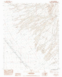
1983 Map of Sablon
USGS Topo · Published 1983About this map
Ward Valley dominates this 1983 provisional survey, where the arid landscape of San Bernardino County is defined by a vast network of Dry Washes draining toward the southeast. The settlement of Sablon sits as a critical point along the Atchison Topeka and Santa Fe RR, which slices diagonally across the valley floor. This rail corridor is supported by engineering features designed to manage the desert's occasional flash floods, including a prominent Dike and Ditch system that protects the right-of-way. The historical transit network is further illustrated by Cadiz Road, which runs parallel to the tracks, connecting this remote desert station to the wider Mojave region. Benchmarks such as BM d1269 221.5 provide precise elevation data for the flat, alluvial terrain that characterizes this segment of the high desert.
Find a feature on this map
13 named features on this map. Tap any name to fly to it.
Don’t see what you’re looking for? This feature index may not catch every label — zoom into the map to look around manually.
Map Details
Editions of this 1983 Sablon Map
This is the sole edition of this map. No revisions or reprints were ever made.
Other maps of this area

1942 · Amboy
USGS Topo · 1:250,000

1943 · Amboy
USGS Topo · 1:250,000

1943 · Turtle Mts.
USGS Topo · 1:62,500

1943 · Iron Mountains
USGS Topo · 1:62,500

1954 · Needles
USGS Topo · 1:250,000

1954 · Turtle Mountains
USGS Topo · 1:62,500

1954 · Rice
USGS Topo · 1:62,500

1956 · Needles
USGS Topo · 1:250,000

1956 · Milligan
USGS Topo · 1:62,500

1956 · Iron Mountains
USGS Topo · 1:62,500