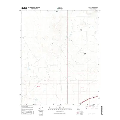
2017 Map of Sacaton Draw
USGS Topo · Published 2017About this map
Double Mills and the ranching settlement of Barrajon anchor this section of Guadalupe County, where water management is the primary shaper of the landscape. The terrain is defined by a sophisticated network of catchments and drainage basins, including Salitre Tank, Upper Tank, and N Los Tanos Tank, which support livestock in this arid environment. Natural drainage flows through Sacaton Draw and along Gonzales Cr, following the descent from the elevated prominence of Boot Hill. For those researching local lineages, the Los Tanos Cem provides a significant genealogical reference point along Los Tanos Rd, situated near the banks of Los Tanos Cr. The map's detailed grid reflects the enduring legacy of the Public Land Survey System, illustrating how land was divided and accessed via routes like Co Rd 1 A F and Simpson Rd.
Find a feature on this map
18 named features on this map. Tap any name to fly to it.
Don’t see what you’re looking for? This feature index may not catch every label — zoom into the map to look around manually.
Map Details
Editions of this 2017 Sacaton Draw Map
This is the sole edition of this map. No revisions or reprints were ever made.
Other maps of this area

1892 · Corazon
USGS Topo · 1:125,000

1894 · Corazon
USGS Topo · 1:125,000

1954 · Santa Fe
USGS Topo · 1:250,000

1954 · Fort Sumner
USGS Topo · 1:250,000

1958 · Fort Sumner
USGS Topo · 1:250,000

1958 · Santa Fe
USGS Topo · 1:250,000

1963 · Santa Rosa
USGS Topo · 1:24,000

1963 · Sunshine Mesa
USGS Topo · 1:24,000

1963 · Mesa Cherisco
USGS Topo · 1:24,000

1963 · Sacaton Draw
USGS Topo · 1:24,000