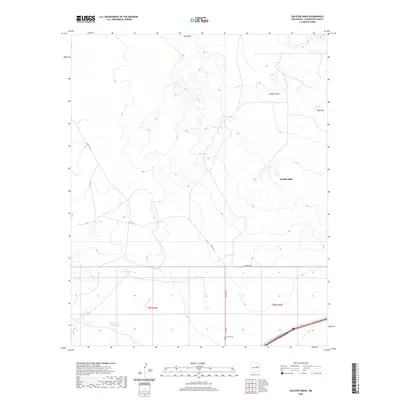
2020 Map of Sacaton Draw
USGS Topo · Published 2020About this map
Sacaton Draw and the surrounding drainage systems define this high-plains landscape in Guadalupe County. Water management is the primary human footprint across the terrain, evidenced by a network of reservoirs and catchment points including Upper Tank, Middle Tank, and Lower Tank. The settlement of Double Mills sits central to the quadrant, while Barrajon occupies the northern reaches. These small outposts reflect the ranching and livestock history of the region where seasonal watercourses like Gonzales Cr and Los Tanos Cr dictate the layout of roads and homesteads.
Find a feature on this map
19 named features on this map. Tap any name to fly to it.
Don’t see what you’re looking for? This feature index may not catch every label — zoom into the map to look around manually.
Map Details
Editions of this 2020 Sacaton Draw Map
This is the sole edition of this map. No revisions or reprints were ever made.
Other maps of this area

1892 · Corazon
USGS Topo · 1:125,000

1894 · Corazon
USGS Topo · 1:125,000

1954 · Santa Fe
USGS Topo · 1:250,000

1954 · Fort Sumner
USGS Topo · 1:250,000

1958 · Fort Sumner
USGS Topo · 1:250,000

1958 · Santa Fe
USGS Topo · 1:250,000

1963 · Santa Rosa
USGS Topo · 1:24,000

1963 · Sunshine Mesa
USGS Topo · 1:24,000

1963 · Mesa Cherisco
USGS Topo · 1:24,000

1963 · Sacaton Draw
USGS Topo · 1:24,000