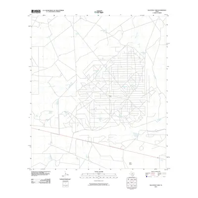
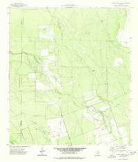
2010 Map of Sacatosa Tank
USGS Topo · Published 2010About this map
Sacatosa Oil Field dominates the central landscape of this South Texas quadrangle, where a dense network of service roads and industrial infrastructure reveals the intensity of energy extraction in Maverick County. The terrain is defined by its drainage systems and water management, with Chimeneas Creek and Chueco Creek cutting through the arid brushland. A distinct pattern of artificial reservoirs, locally termed tanks, serves the ranching and industrial needs of the region. These features, such as Sacatosa Tank, Antonio Tank, and Comanche Tank, provide essential water points in a landscape otherwise marked by seasonal stream beds. In the southern portion of the map, the Farias Ranch Airport indicates the large-scale landholdings and private aviation common to this part of the Texas borderlands during the early 21st century.
Find a feature on this map
17 named features on this map. Tap any name to fly to it.
Don’t see what you’re looking for? This feature index may not catch every label — zoom into the map to look around manually.
Map Details
Editions of this 2010 Sacatosa Tank Map
This is the sole edition of this map. No revisions or reprints were ever made.
Other maps of this area

1940 · Cometa
USGS Topo · 1:62,500

1940 · Eagle Pass
USGS Topo · 1:62,500

1940 · Paloma
USGS Topo · 1:62,500

1940 · Chacon Creek
USGS Topo · 1:62,500

1958 · Eagle Pass
USGS Topo · 1:250,000

1965 · Eagle Pass
USGS Topo · 1:250,000
1974 · Cometa
USGS Topo · 1:24,000
1974 · Indian Tank
USGS Topo · 1:24,000
1974 · Sacatosa Tank
USGS Topo · 1:24,000
1974 · Chacon Creek SE
USGS Topo · 1:24,000