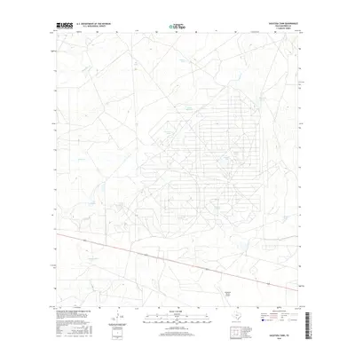
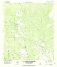
2016 Map of Sacatosa Tank
USGS Topo · Published 2016About this map
Sacatosa Tank and an extensive network of water catchments define this semi-arid landscape in Maverick County, where the management of water is central to ranching operations. The terrain is drained by ephemeral systems like Chueco Cr and Chimeneas Cr, which feed into numerous named reservoirs such as Antonio Tank and San Pablo Tank. A highly structured grid of private ranch roads dominates the eastern half of the map, illustrating the scale of landholdings in this part of South Texas. The presence of the Comanche Ranch Airport in the south underscores the reliance on private aviation for managing these large, isolated properties. Further west, more isolated features like Taza Tank and Truitt Tank sit among subtle elevation changes, while the southern boundary is marked by a long, straight stretch of highway connecting this ranching country to the wider region.
Find a feature on this map
17 named features on this map. Tap any name to fly to it.
Don’t see what you’re looking for? This feature index may not catch every label — zoom into the map to look around manually.
Map Details
Editions of this 2016 Sacatosa Tank Map
This is the sole edition of this map. No revisions or reprints were ever made.
Other maps of this area

1940 · Cometa
USGS Topo · 1:62,500

1940 · Eagle Pass
USGS Topo · 1:62,500

1940 · Paloma
USGS Topo · 1:62,500

1940 · Chacon Creek
USGS Topo · 1:62,500

1958 · Eagle Pass
USGS Topo · 1:250,000

1965 · Eagle Pass
USGS Topo · 1:250,000
1974 · Cometa
USGS Topo · 1:24,000
1974 · Indian Tank
USGS Topo · 1:24,000
1974 · Sacatosa Tank
USGS Topo · 1:24,000
1974 · Chacon Creek SE
USGS Topo · 1:24,000