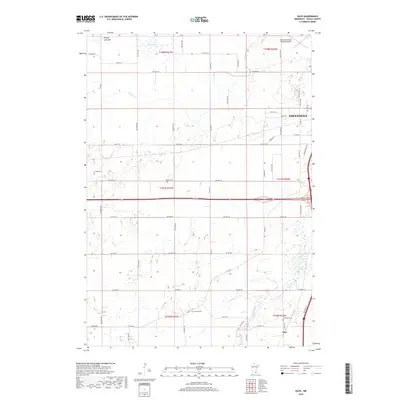
2019 Map of Saco
USGS Topo · Published 2019About this map
The western edge of Owatonna and the rural lands of Steele County define this 2019 landscape, where agricultural fields are punctuated by family and community history. The topography reveals several local water features, including the Straight River and Crane Cr, as well as the notable Pelican Lake Bed in the northwest. Local genealogical and community landmarks are prominent, including four distinct cemeteries: Lincoln Cem, Mueller Cem, Lemond Cem, and Bohemian Cem, the latter located near the small settlement of Saco. Transportation and infrastructure are anchored by the Owatonna Degner Regional Airport in the northeast and a modern road network including Co Hwy 18 and Lemond Rd. The map illustrates the contemporary balance between Owatonna's suburban expansion and the enduring township structure of the Minnesota prairie.
Find a feature on this map
34 named features on this map. Tap any name to fly to it.
Don’t see what you’re looking for? This feature index may not catch every label — zoom into the map to look around manually.
Map Details
Editions of this 2019 Saco Map
This is the sole edition of this map. No revisions or reprints were ever made.
Other maps of this area

1953 · Saint Paul
USGS Topo · 1:250,000

1954 · Mason City
USGS Topo · 1:250,000

1957 · Mason City
USGS Topo · 1:250,000

1958 · Mason City
USGS Topo · 1:250,000

1959 · Saint Paul
USGS Topo · 1:250,000

1962 · Medford East
USGS Topo · 1:24,000

1962 · Morristown
USGS Topo · 1:24,000

1962 · Owatonna
USGS Topo · 1:24,000

1962 · Saco
USGS Topo · 1:24,000

1962 · Meriden
USGS Topo · 1:24,000