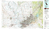
1994 Map of Sacramento
USGS Topo · Published 1994About this map
Sacramento serves as the focal point of this regional study, which illustrates the complex water management systems of the Central Valley in the mid-1990s. The landscape is defined by the confluence of the Sacramento River and American River, alongside massive flood control infrastructure like the Sutter Bypass and Yolo Bypass. This network of bypasses and weirs, including the Sacramento Weir, reflects the ongoing engineering required to protect the growing urban centers from seasonal flooding.
Find a feature on this map
174 named features on this map. Tap any name to fly to it.
Don’t see what you’re looking for? This feature index may not catch every label — zoom into the map to look around manually.
Map Details
Editions of this 1994 Sacramento Map
2 editions found
Other maps of this area

1888 · Marysville
USGS Topo · 1:125,000

1888 · Smartsville
USGS Topo · 1:125,000

1889 · Jackson
USGS Topo · 1:125,000

1891 · Sacramento
USGS Topo · 1:125,000

1891 · Colfax
USGS Topo · 1:125,000

1891 · Marysville
USGS Topo · 1:125,000

1891 · Smartsville
USGS Topo · 1:125,000

1891 · Placerville
USGS Topo · 1:125,000

1892 · Jackson
USGS Topo · 1:125,000

1892 · Sacramento
USGS Topo · 1:125,000