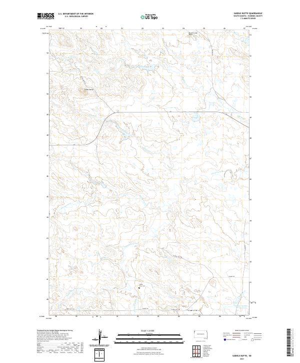
2021 Map of Saddle Butte
USGS Topo · Published 2021About this map
The S Fork Grand River and Little Grand River wind through the arid landscape of Harding County, defining the drainage patterns of this sparsely populated ranching region. The high ground is punctuated by distinct landforms like Saddle Butte and Brush Creek Butte, while the drainage network includes Pine Spring Cr, Graves Creek, and Brush Creek. For genealogists and local historians, the Grand River Cem near the river fork serves as a significant site for family research in this quiet corner of South Dakota.
Find a feature on this map
24 named features on this map. Tap any name to fly to it.
Don’t see what you’re looking for? This feature index may not catch every label — zoom into the map to look around manually.
Map Details
Editions of this 2021 Saddle Butte Map
This is the sole edition of this map. No revisions or reprints were ever made.
Other maps of this area

1935 · Harding
USGS Topo · 1:125,000

1935 · Buffalo
USGS Topo · 1:125,000

1954 · Lemmon
USGS Topo · 1:250,000

1957 · Lemmon
USGS Topo · 1:250,000

1971 · Buffalo
USGS Topo · 1:24,000
1971 · Lahti Butte
USGS Topo · 1:24,000

1971 · McKenzie Butte
USGS Topo · 1:24,000

1971 · Saddle Butte
USGS Topo · 1:24,000

1973 · Bog Creek
USGS Topo · 1:24,000

1973 · Gallup Creek
USGS Topo · 1:24,000