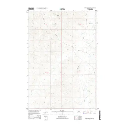
2017 Map of Saddle Horse Butte
USGS Topo · Published 2017About this map
Saddle Horse Butte stands as a prominent landmark in this section of Custer County, overlooking a network of ephemeral drainages and ranch roads. The landscape is defined by the winding course of Mizpah Creek and its various tributaries, including Dawson Cr, Deer Cr, and Sand Cr. These waterways carve through the high plains, dictating the placement of historic transit routes like Powderville Rd and Mizpah Rd. The map illustrates a classic Montana rangeland pattern, where the vast township and range system—shown here through boundaries like t3n r51e and t2n r50e—organizes the territory. The convergence of Lindsey Cr and L O Cr into the larger Mizpah drainage highlights the vital importance of water access in this arid environment, providing a detailed look at the geographic features that have guided local land use for generations.
Find a feature on this map
18 named features on this map. Tap any name to fly to it.
Don’t see what you’re looking for? This feature index may not catch every label — zoom into the map to look around manually.
Map Details
Editions of this 2017 Saddle Horse Butte Map
This is the sole edition of this map. No revisions or reprints were ever made.
Other maps of this area

1953 · Miles City
USGS Topo · 1:250,000

1954 · Ekalaka
USGS Topo · 1:250,000

1956 · Ekalaka
USGS Topo · 1:250,000

1957 · Miles City
USGS Topo · 1:250,000

1958 · Miles City
USGS Topo · 1:250,000

1958 · Ekalaka
USGS Topo · 1:250,000

1965 · Ekalaka
USGS Topo · 1:250,000

1969 · Forty Creek
USGS Topo · 1:24,000

1969 · Miles City Creek
USGS Topo · 1:24,000
1969 · Beebe
USGS Topo · 1:24,000