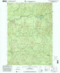
1997 Map of Saddleblanket Mountain
USGS Topo · Published 2001About this map
Willamette National Forest encompasses this heavily timbered region of Lane County, where steep drainages and mountain peaks dominate the landscape. The Saddleblanket Mountain Lookout stands as a primary landmark above a complex network of waterways, including Fall Creek and the many branches of Winberry Creek. Evidence of industrial use is found in scattered Quarry sites throughout the hills, while recreational development is marked by the Johnny Creek Nature Trail and the Recreation Trail winding through the Clark Creek area. Smaller navigational aids like the Little Blanket Shelter and significant water features such as Chichester Falls and Big Pool highlight the intersection of backcountry utility and natural geography in the late twentieth century.
Find a feature on this map
31 named features on this map. Tap any name to fly to it.
Don’t see what you’re looking for? This feature index may not catch every label — zoom into the map to look around manually.
Map Details
Editions of this 1997 Saddleblanket Mountain Map
This is the sole edition of this map. No revisions or reprints were ever made.
Other maps of this area

1925 · Waldo Lake
USGS Topo · 1:125,000

1934 · Mc Kenzie Bridge
USGS Topo · 1:96,000

1935 · Lowell
USGS Topo · 1:96,000

1940 · Mc Kenzie Bridge
USGS Topo · 1:125,000

1942 · Lowell
USGS Topo · 1:125,000

1951 · Leaburg
USGS Topo · 1:62,500

1953 · Salem
USGS Topo · 1:250,000

1954 · Salem
USGS Topo · 1:250,000

1955 · Hardesty Mtn
USGS Topo · 1:62,500

1955 · Blue River
USGS Topo · 1:62,500