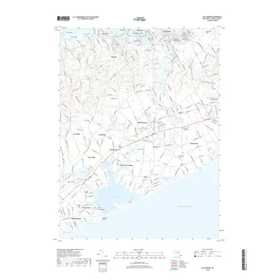
2019 Map of Sag Harbor
USGS Topo · Published 2019About this map
Sag Harbor and its neighboring coastal hamlets define the landscape of the South Fork of Long Island in this 2019 survey. The map details a densely settled maritime environment where historic village centers like Bridgehampton, Water Mill, and Sagaponack are interspersed with numerous freshwater bodies such as Long Pond and Poxabogue Pond. A significant concentration of burial grounds, including the Saint Davids African Methodist Episcopal Zion Cem and Water Mill Cem, highlights the area's deep-rooted community history.
Find a feature on this map
261 named features on this map. Tap any name to fly to it.
Don’t see what you’re looking for? This feature index may not catch every label — zoom into the map to look around manually.
Map Details
Editions of this 2019 Sag Harbor Map
This is the sole edition of this map. No revisions or reprints were ever made.
Other maps of this area

1903 · Sag Harbor
USGS Topo · 1:62,500

1903 · Gardiners Island
USGS Topo · 1:62,500

1904 · Sag Harbor
USGS Topo · 1:62,500

1904 · Shelter Island
USGS Topo · 1:62,500

1904 · Easthampton
USGS Topo · 1:62,500

1904 · Gardiners Island
USGS Topo · 1:62,500

1921 · Gardiners Island
USGS Topo · 1:62,500

1921 · Easthampton
USGS Topo · 1:62,500

1944 · Gardiners Island West
USGS Topo · 1:24,000

1946 · Sag Harbor
USGS Topo · 1:24,000