
2023 Map of Sag Harbor
USGS Topo · Published 2023About this map
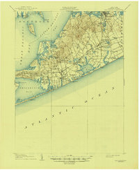
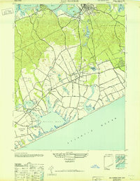
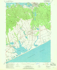
Sag Harbor anchors this coastal survey, where the historic maritime character of Long Island meets the modern residential landscape of the Hamptons. The map documents an intricate network of inland waterways and coastal ponds, from the northern reaches of Noyack Bay down to the sprawling Mecox Bay and the Atlantic shoreline at Watermill Beach. Genealogists and local historians will find significant detail in the numerous burial grounds, including the large Oakland Cem and the Saint David African Methodist Episcopal Zion Cem in the north.
Find a feature on this map
247 named features on this map. Tap any name to fly to it.
Don’t see what you’re looking for? This feature index may not catch every label — zoom into the map to look around manually.
Map Details
Editions of this 2023 Sag Harbor Map
This is the sole edition of this map. No revisions or reprints were ever made.
Historical Maps of Sagaponack Through Time
5 maps found

Featured Locations
- East Hampton, NY
- Southampton, NY
- North Sea, Southampton
- Southampton, Southampton
- Northwest Harbor, East Hampton