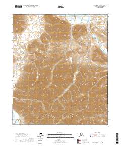
2017 Map of Sagavanirktok A-1 SE
USGS Topo · Published 2017About this map
Niviak Pass serves as a primary geographic anchor in this section of the North Slope, where the high-altitude terrain of the Brooks Range begins its descent toward the Arctic coastal plain. The landscape is defined by the braided paths of the Echooka River in the northeast and the Ivishak River in the southwest, showcasing the natural drainage patterns of this unpopulated wilderness. This 2017 study illustrates the raw topography of the region as it existed in the early 21st century, prior to any significant infrastructure development. The map meticulously records contour intervals that reveal the complex ridges and valleys surrounding the pass, providing a vital resource for understanding the physical geography of one of the most secluded areas in the United States.
Find a feature on this map
7 named features on this map. Tap any name to fly to it.
Don’t see what you’re looking for? This feature index may not catch every label — zoom into the map to look around manually.
Map Details
Editions of this 2017 Sagavanirktok A-1 SE Map
This is the sole edition of this map. No revisions or reprints were ever made.
Other maps of this area

1951 · Sagavanirktok D-5
USGS Topo · 1:250,000

1951 · Brooks
USGS Topo · 1:250,000

1951 · Arctic
USGS Topo · 1:250,000

1951 · Mt. Michelson
USGS Topo · 1:250,000

1956 · Arctic
USGS Topo · 1:250,000

1956 · Mt. Michelson
USGS Topo · 1:250,000

1956 · Philip Smith Mountains
USGS Topo · 1:250,000

1956 · Sagavanirktok
USGS Topo · 1:250,000

1958 · Sagavanirktok
USGS Topo · 1:250,000

1964 · Philip Smith Mountains
USGS Topo · 1:250,000