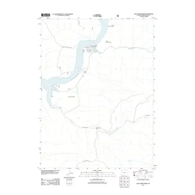
2012 Map of Sage Creek Basin
USGS Topo · Published 2012About this map
Firehole Canyon and its designated Firehole Canyon Campground serve as a focal point for recreation along the eastern shoreline of the Flaming Gorge Reservoir. This high-desert landscape in Sweetwater County is defined by dramatic geological markers such as North Chimney Rock and South Chimney Rock, which overlook the northern reaches of the Flaming Gorge Natl Rec Area. The map details the drainage patterns of the Sage Creek Basin, where Sage Cr and the ephemeral Greasewood Draw carve through the arid terrain. Transportation through these badlands is marked by the Webster Dugway and several regional routes like Flaming Gorge Rd, which provide access to remote water sources like Greasewood Spring.
Find a feature on this map
16 named features on this map. Tap any name to fly to it.
Don’t see what you’re looking for? This feature index may not catch every label — zoom into the map to look around manually.
Map Details
Editions of this 2012 Sage Creek Basin Map
This is the sole edition of this map. No revisions or reprints were ever made.
Other maps of this area

1954 · Rock Springs
USGS Topo · 1:250,000

1957 · Currant Creek Ranch
USGS Topo · 1:62,500

1957 · Mc Kinnon Junction
USGS Topo · 1:62,500

1957 · Firehole Basin
USGS Topo · 1:62,500

1958 · Rock Springs
USGS Topo · 1:250,000

1962 · Rock Springs
USGS Topo · 1:250,000

1966 · Firehole Basin
USGS Topo · 1:62,500

1966 · Mc Kinnon Junction
USGS Topo · 1:62,500

1966 · Buckboard Crossing
USGS Topo · 1:62,500

1966 · Currant Creek Ranch
USGS Topo · 1:62,500