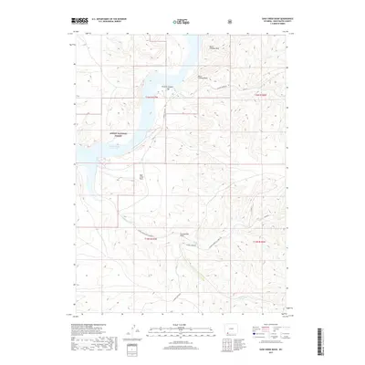
2017 Map of Sage Creek Basin
USGS Topo · Published 2017About this map
Ashley National Forest and the expansive Flaming Gorge Reservoir dominate this 2017 study of the high desert landscape. The terrain is defined by dramatic geological formations, most notably North Chimney Rock and South Chimney Rock, which overlook the reservoir and the steep walls of Firehole Canyon. The map reveals a land structured by drainage patterns and remote access, where Sage Cr winds through the Sage Creek Basin toward the main body of water. Sparse water sources like Greasewood Spring and topographic features such as Greasewood Draw indicate a landscape where geography dictates movement. A network of secondary routes, including the Flaming Gorge Rd and various county roads, provides the only infrastructure through these public lands.
Find a feature on this map
19 named features on this map. Tap any name to fly to it.
Don’t see what you’re looking for? This feature index may not catch every label — zoom into the map to look around manually.
Map Details
Editions of this 2017 Sage Creek Basin Map
This is the sole edition of this map. No revisions or reprints were ever made.
Other maps of this area

1954 · Rock Springs
USGS Topo · 1:250,000

1957 · Currant Creek Ranch
USGS Topo · 1:62,500

1957 · Mc Kinnon Junction
USGS Topo · 1:62,500

1957 · Firehole Basin
USGS Topo · 1:62,500

1958 · Rock Springs
USGS Topo · 1:250,000

1962 · Rock Springs
USGS Topo · 1:250,000

1966 · Firehole Basin
USGS Topo · 1:62,500

1966 · Mc Kinnon Junction
USGS Topo · 1:62,500

1966 · Buckboard Crossing
USGS Topo · 1:62,500

1966 · Currant Creek Ranch
USGS Topo · 1:62,500