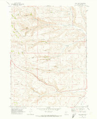
1969 Map of Sage Creek
USGS Topo · Published 1973About this map
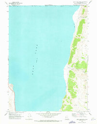
Hogback Ridge dominates the center of this Rich County landscape, a prominent geological spine separating the drainage systems of Sixmile Creek to the north and Duck Creek to the south. In the late 1960s, this area remained largely undeveloped rangeland, defined by its intricate network of water sources. Small-scale resource extraction is evident near the South Fork of Duck Creek, where a Mine and several Gravel Pits are located. The abundance of named springs, such as Barrel Spring, Rabbit Spring, and Hidden Spring, suggests the critical importance of water rights and livestock watering holes in this high-altitude environment. To the south, the landscape transitions toward the Sage Creek valley, where a managed Canal appears, indicating the move from natural runoff to irrigation infrastructure for local agriculture near the Wyoming border.
Find a feature on this map
29 named features on this map. Tap any name to fly to it.
Don’t see what you’re looking for? This feature index may not catch every label — zoom into the map to look around manually.
Map Details
Editions of this 1969 Sage Creek Map
2 editions found
Other maps of this area

1912 · Randolph
USGS Topo · 1:125,000

1954 · Ogden
USGS Topo · 1:250,000

1958 · Ogden
USGS Topo · 1:250,000

1960 · Ogden
USGS Topo · 1:250,000

1968 · Rex Peak
USGS Topo · 1:24,000

1968 · Randolph
USGS Topo · 1:24,000

1969 · Sheeppen Creek
USGS Topo · 1:24,000
1969 · Leefe
USGS Topo · 1:24,000
1969 · South Lake
USGS Topo · 1:24,000
1969 · Bear Lake South
USGS Topo · 1:24,000