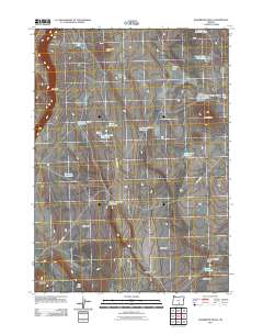
2011 Map of Sagebrush Knoll
USGS Topo · Published 2011About this map
The high desert terrain of Harney County is defined by its water management and distinct landforms, including the prominent Eagle Butte and the extensive Abert Rim. This 2011 survey documents a landscape reliant on seasonal water sources and livestock infrastructure, as evidenced by the distribution of numerous man-made and natural catchments like Sherlock Gulch Reservoir, Crazy Reservoir, and South Lake Waterhole. The map illustrates a network of drainage systems and depressions, such as Badger Draw and Dent Draw, which help navigate the high-plateau geography. The naming of areas like Nasty Flat and Sagebrush Knoll suggests the character of the vegetation and soil encountered by those who work this land. Transportation in this arid region is limited to essential connectors like Corn Lake Rd and County Rd 6185, which provide the few access points through the Flint Hills.
Find a feature on this map
25 named features on this map. Tap any name to fly to it.
Don’t see what you’re looking for? This feature index may not catch every label — zoom into the map to look around manually.
Map Details
Editions of this 2011 Sagebrush Knoll Map
This is the sole edition of this map. No revisions or reprints were ever made.
Other maps of this area

1955 · Klamath Falls
USGS Topo · 1:250,000

1955 · Adel
USGS Topo · 1:250,000

1957 · Adel
USGS Topo · 1:250,000

1958 · Klamath Falls
USGS Topo · 1:250,000

1958 · Adel
USGS Topo · 1:250,000

1962 · Adel
USGS Topo · 1:250,000

1966 · Rabbit Hills NE
USGS Topo · 1:24,000

1966 · Rabbit Hills NW
USGS Topo · 1:24,000

1968 · Commodore Ridge
USGS Topo · 1:24,000

1974 · Lake Abert
USGS Topo · 1:100,000