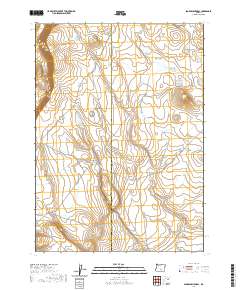
2020 Map of Sagebrush Knoll
USGS Topo · Published 2020About this map
The high desert landscape of the Oregon outback is defined by the subtle topography of the Flint Hills and Flint Ridge in the southern portion of this quadrangle. This 2020 survey tracks the precise boundary of the Lake Co Harney Co line as it bisects the high country. Human activity is represented primarily through a network of remote access routes, including Corn Lake Rd and Co Rd 6185, which navigate the drainage systems like Badger Draw. The presence of the Nat For Dev Rd 6130 indicates the managed nature of this landscape, where land use is dictated by federal oversight and the rugged requirements of the Great Basin terrain. It is a map of wide-open spaces where relief is found in named ridges and the occasional county road.
Find a feature on this map
12 named features on this map. Tap any name to fly to it.
Don’t see what you’re looking for? This feature index may not catch every label — zoom into the map to look around manually.
Map Details
Editions of this 2020 Sagebrush Knoll Map
This is the sole edition of this map. No revisions or reprints were ever made.
Other maps of this area

1955 · Klamath Falls
USGS Topo · 1:250,000

1955 · Adel
USGS Topo · 1:250,000

1957 · Adel
USGS Topo · 1:250,000

1958 · Klamath Falls
USGS Topo · 1:250,000

1958 · Adel
USGS Topo · 1:250,000

1962 · Adel
USGS Topo · 1:250,000

1966 · Rabbit Hills NE
USGS Topo · 1:24,000

1966 · Rabbit Hills NW
USGS Topo · 1:24,000

1968 · Commodore Ridge
USGS Topo · 1:24,000

1974 · Lake Abert
USGS Topo · 1:100,000