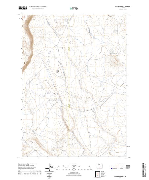
2023 Map of Sagebrush Knoll
USGS Topo · Published 2023About this map
The high desert border between Lake and Harney Counties is defined by a sparse network of forest development and county roads in this 2023 survey. This arid landscape is marked by prominent geological formations in the southwest, specifically Flint Ridge and the Flint Hills, which rise above the surrounding plateaus. The drainage pattern is led by Badger Draw, which cuts through the northern sections of the map area. This modern topographic record captures the region's character as a managed wilderness, where access is provided by routes such as Corn Lake Rd and Nat For Dev Rd 6130. The map serves as a contemporary guide to the public lands and section lines that structure this remote part of Southeastern Oregon.
Find a feature on this map
13 named features on this map. Tap any name to fly to it.
Don’t see what you’re looking for? This feature index may not catch every label — zoom into the map to look around manually.
Map Details
Editions of this 2023 Sagebrush Knoll Map
This is the sole edition of this map. No revisions or reprints were ever made.
Other maps of this area

1955 · Klamath Falls
USGS Topo · 1:250,000

1955 · Adel
USGS Topo · 1:250,000

1957 · Adel
USGS Topo · 1:250,000

1958 · Klamath Falls
USGS Topo · 1:250,000

1958 · Adel
USGS Topo · 1:250,000

1962 · Adel
USGS Topo · 1:250,000

1966 · Rabbit Hills NE
USGS Topo · 1:24,000

1966 · Rabbit Hills NW
USGS Topo · 1:24,000

1968 · Commodore Ridge
USGS Topo · 1:24,000

1974 · Lake Abert
USGS Topo · 1:100,000