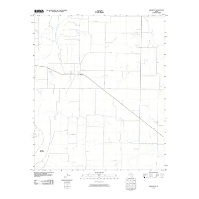
2010 Map of Sagerton
USGS Topo · Published 2010About this map
Sagerton serves as the central hub of this West Texas landscape, situated at the intersection of several farm-to-market roads and local county routes. The settlement's street grid, including Johnson Ave, reflects a classic rural community layout amidst the agricultural expanses of Haskell County. To the west, the terrain is dominated by the prominent elevation of Flat Top Mountain, while the hydrology of the region is defined by the Double Mountain Fork Brazos River as it winds through the northwest corner. This area is characterized by an extensive network of drainage systems, including Gyp Creek, Willow Creek, and Paint Creek, which cut through the landscape. The map's detailed road network, consisting largely of numbered county roads like Co Rd 490 and Co Rd 448, illustrates the organized land division and the rural connectivity essential for the local ranching and farming economy during the early 21st century.
Find a feature on this map
34 named features on this map. Tap any name to fly to it.
Don’t see what you’re looking for? This feature index may not catch every label — zoom into the map to look around manually.
Map Details
Editions of this 2010 Sagerton Map
This is the sole edition of this map. No revisions or reprints were ever made.
Other maps of this area

1891 · Anson
USGS Topo · 1:125,000

1893 · Roby
USGS Topo · 1:125,000

1893 · Anson
USGS Topo · 1:125,000

1925 · Aspermont 4-a
USGS Topo · 1:48,000

1925 · Haskell 3-b
USGS Topo · 1:48,000

1931 · Aspermont
USGS Topo · 1:62,500

1954 · Lubbock
USGS Topo · 1:250,000

1954 · Big Spring
USGS Topo · 1:250,000

1954 · Abilene
USGS Topo · 1:250,000

1954 · Wichita Falls
USGS Topo · 1:250,000