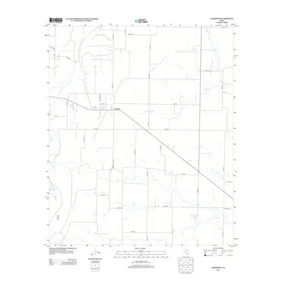
2012 Map of Sagerton
USGS Topo · Published 2012About this map
The Sagerton community anchors this landscape in Haskell County, where the street grid of 1st St, 3rd St, and Jefferson Ave meets the intersection of Ranch Road 1661 and local county routes. The terrain is defined by its drainage systems, most notably the Double Mountain Fork Brazos River snaking through the northwest corner. This 2012 survey illustrates a quiet agricultural region marked by numerous small tributaries like Willow Creek, Gyp Creek, and Paint Creek, which carve gentle patterns across the plains.
Find a feature on this map
45 named features on this map. Tap any name to fly to it.
Don’t see what you’re looking for? This feature index may not catch every label — zoom into the map to look around manually.
Map Details
Editions of this 2012 Sagerton Map
This is the sole edition of this map. No revisions or reprints were ever made.
Other maps of this area

1891 · Anson
USGS Topo · 1:125,000

1893 · Roby
USGS Topo · 1:125,000

1893 · Anson
USGS Topo · 1:125,000

1925 · Aspermont 4-a
USGS Topo · 1:48,000

1925 · Haskell 3-b
USGS Topo · 1:48,000

1931 · Aspermont
USGS Topo · 1:62,500

1954 · Lubbock
USGS Topo · 1:250,000

1954 · Big Spring
USGS Topo · 1:250,000

1954 · Abilene
USGS Topo · 1:250,000

1954 · Wichita Falls
USGS Topo · 1:250,000