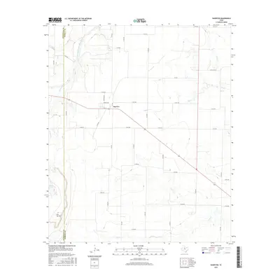
2016 Map of Sagerton
USGS Topo · Published 2016About this map
Sagerton serves as the central hub of this West Texas landscape, situated at the intersection of FM 1661 and local thoroughfares like Harrison Ave and Garfield Ave. The terrain is defined by a series of seasonal drainages and creek beds that carve through the cattle country of Haskell and Stonewall Counties. To the northwest, the Double Mountain Fork Brazos River winds across the county line, while the southern reaches of the map are marked by the prominent elevation of Flat Top Mtn. The rural character of the area is reinforced by a dense network of county roads such as Co Rd 490 and Co Rd 446, providing access to isolated livestock tanks like Salt Br Tank. This 2016 survey illustrates the persistent ranching and agricultural grid that has shaped this region for generations, showing how local water sources like Paint Cr and Gyp Cr continue to dictate the placement of roads and homesteads.
Find a feature on this map
45 named features on this map. Tap any name to fly to it.
Don’t see what you’re looking for? This feature index may not catch every label — zoom into the map to look around manually.
Map Details
Editions of this 2016 Sagerton Map
This is the sole edition of this map. No revisions or reprints were ever made.
Other maps of this area

1891 · Anson
USGS Topo · 1:125,000

1893 · Roby
USGS Topo · 1:125,000

1893 · Anson
USGS Topo · 1:125,000

1925 · Aspermont 4-a
USGS Topo · 1:48,000

1925 · Haskell 3-b
USGS Topo · 1:48,000

1931 · Aspermont
USGS Topo · 1:62,500

1954 · Lubbock
USGS Topo · 1:250,000

1954 · Big Spring
USGS Topo · 1:250,000

1954 · Abilene
USGS Topo · 1:250,000

1954 · Wichita Falls
USGS Topo · 1:250,000