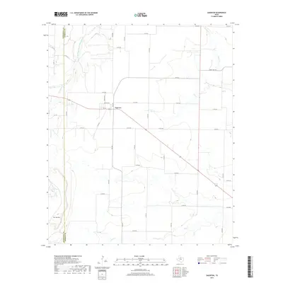
2019 Map of Sagerton
USGS Topo · Published 2019About this map
Sagerton serves as the central hub of this West Texas landscape, where the grids of Haskell and Stonewall counties meet. The terrain is defined by the winding course of the Double Mountain Fork Brazos River in the northwest, cutting through the high plains toward the confluence of several seasonal drainages. Notable water features such as Paint Cr, Coon Cr, and Gyp Cr carve low-relief draws across the ranchland and cotton fields. In the southwestern corner, the prominent rise of Flat Top Mtn provides a distinct landmark against the surrounding level horizons. The map illustrates a dense network of rural infrastructure, including Farm to Market Road 1661 and numerous county roads like Co RD 490, which connect isolated homesteads and ranching operations. The presence of features like Salt Br Tank highlights the importance of water management in this arid region of the Rolling Plains.
Find a feature on this map
45 named features on this map. Tap any name to fly to it.
Don’t see what you’re looking for? This feature index may not catch every label — zoom into the map to look around manually.
Map Details
Editions of this 2019 Sagerton Map
This is the sole edition of this map. No revisions or reprints were ever made.
Other maps of this area

1891 · Anson
USGS Topo · 1:125,000

1893 · Roby
USGS Topo · 1:125,000

1893 · Anson
USGS Topo · 1:125,000

1925 · Aspermont 4-a
USGS Topo · 1:48,000

1925 · Haskell 3-b
USGS Topo · 1:48,000

1931 · Aspermont
USGS Topo · 1:62,500

1954 · Lubbock
USGS Topo · 1:250,000

1954 · Big Spring
USGS Topo · 1:250,000

1954 · Abilene
USGS Topo · 1:250,000

1954 · Wichita Falls
USGS Topo · 1:250,000