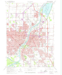
2023 Map of Saginaw
USGS Topo · Published 2023About this map
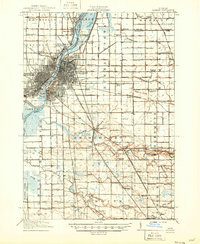
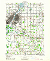
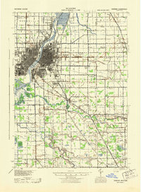
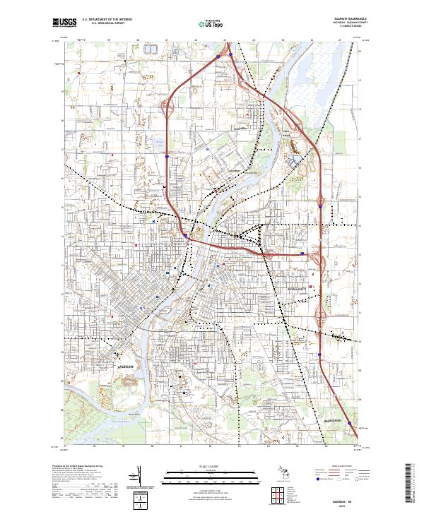
The Saginaw River serves as the central artery for this industrial and ecological landscape, flowing past the urban core of Saginaw and north through Carrollton and Zilwaukee. The map illustrates a city defined by its relationship to the water, from the densely gridded streets surrounding the Saginaw County Courthouse to the preserved wetlands of the Shiawassee National Wildlife Refuge at the confluence of the Tittabawassee River, Cass River, and Saginaw River. To the south, the terrain opens into significant conservation areas like Green Point, while the northern reaches are marked by river features such as Crow Island and the Carrollton Bar. This document provides a meticulous record of the region's cemeteries, including Bethlehem Cem and Mount Olivet Cem, which are vital for genealogical research in these long-established riverfront communities.
Find a feature on this map
43 named features on this map. Tap any name to fly to it.
Don’t see what you’re looking for? This feature index may not catch every label — zoom into the map to look around manually.
Map Details
Editions of this 2023 Saginaw Map
This is the sole edition of this map. No revisions or reprints were ever made.
Historical Maps of Zilwaukee Township Through Time
5 maps found